
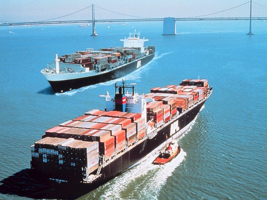
The container ship Hansa Carrier was having a rough time of it.
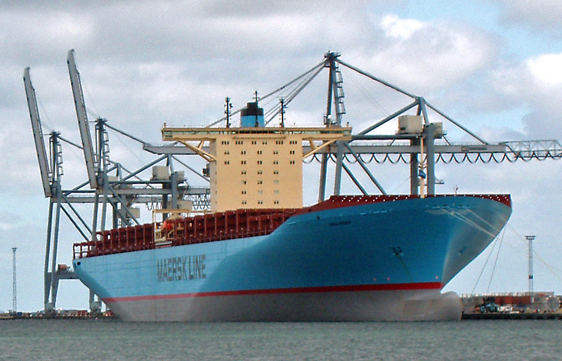
It was oh-dark-hundred on May 27th, 1990, and she was in the middle of the cold, cold waters of the North Pacific, 500 miles south of Alaska and still 1,700 out from her destination of Seattle, Washington. For a 527-foot ship, she was getting pretty badly beaten, pummeled by monstrous swell, and rolling heavily. In those days container ships got weather updates customized to their routes every twelve hours, but stuff in the North Pacific happens way faster than that. If she was like most container ships (we don’t have a lot of information on this), the boxcar-sized containers were stacked up to eight high above decks, which creates a blank vertical wall eighty feet tall, presented without any contouring or nuancing to whatever the ocean has for you. You’re a giant target for both wind and swell, and the swell in that area hits thirty and forty feet all the time.
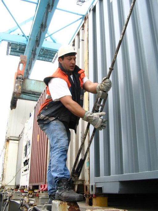
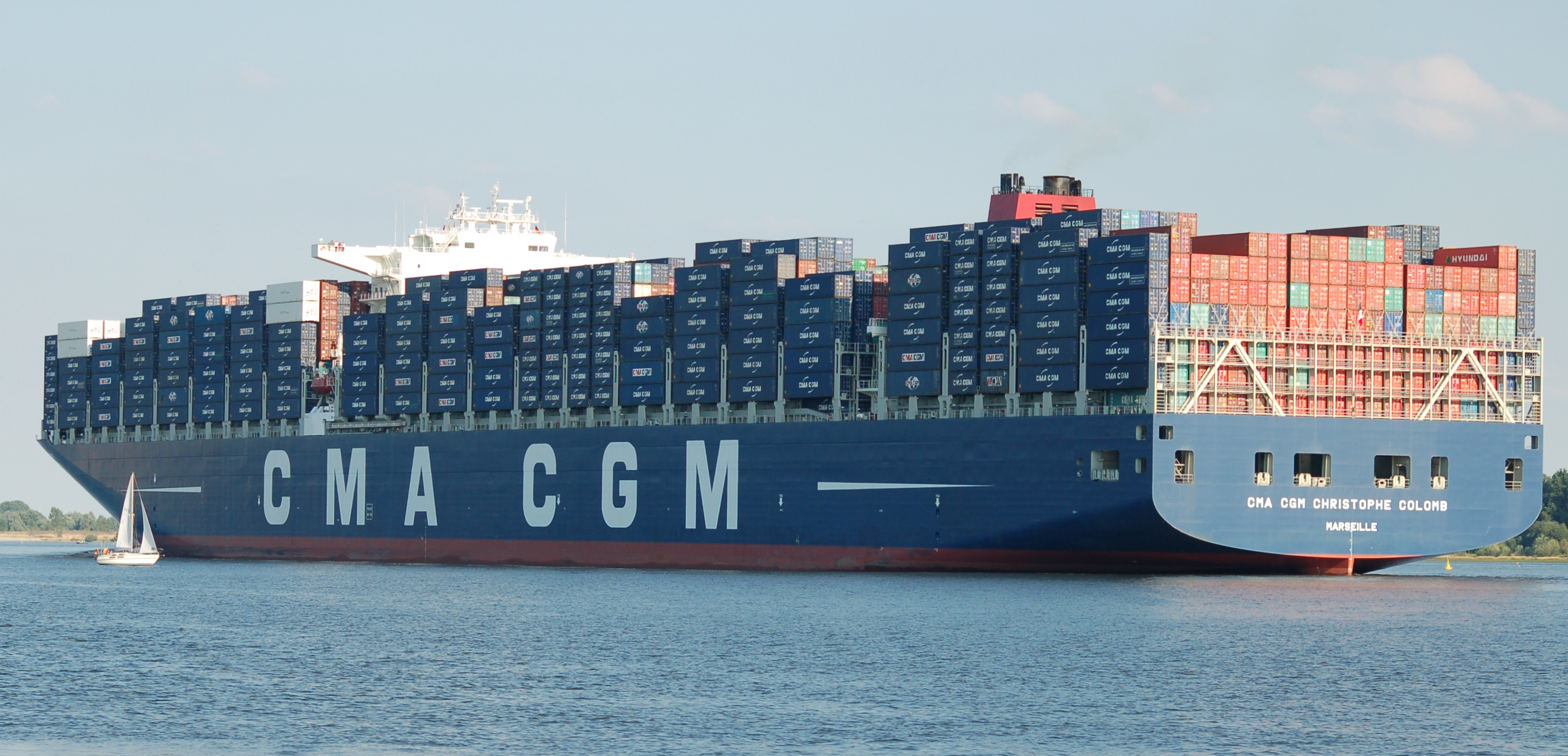
Shipping containers and lashing rods By Danny Cornelissen (http://www.portpictures.nl) [Attribution], via Wikimedia Commons
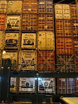
A Solid Wall of Shipping Containers By Danny Cornelissen (http://www.portpictures.nl) [Attribution], via Wikimedia Commons
Those things could have hit the water doing 62 miles per hour.
Anyway, for whatever reason, they ruptured and spilled their contents.
And so, in the greatest windfall of free data in the history of oceanography, 61,820 ID-numbered Nike sneakers hit the water simultaneously at a known place and time.
* * *
This was the heyday of the high-priced sneaker, and the press was full of stories about inner-city kids spending small fortunes on tennis shoes, so when these fairly precious things started washing up all over the coasts of Washington, Oregon and British Columbia, it created quite a sensation. No one had known they were coming, because manufacturers and shipping companies keep their container losses fairly quiet. It’s estimated that ten thousand containers go in the drink each year, and the companies just file their insurance claims and go on with life. The Monterey Bay Aquarium Research Institute (MBARI) is even doing a study about what all those containers might be doing to the marine ecosystems on the ocean floor. They presumably are concentrated under the shipping lanes, where they may be creating stepping-stone pathways for sessile (attached) organisms to make inroads into sandy sea floor habitats where they have never been before.
The beachcomber community in Oregon and Washington is quite well-developed, because those coastlines are touched by the North Pacific Current, which barrels eastward all the way from Asia, hits the northwest coast of the US and turns both north and south, creating a gigantic gyre below called the Subtropical Gyre, and a slightly less gigantic gyre above called the Subarctic Gyre. This brings all manner of fun stuff from extremely exotic lands to the beaches of Oregon, Washington and British Columbia, and makes the region one of the beachcombing capitals of the world. It took the shoes nine months to hit the coast, though no one could have predicted that at the time, because little was known about the North Pacific gyres at the time. That was about to change.
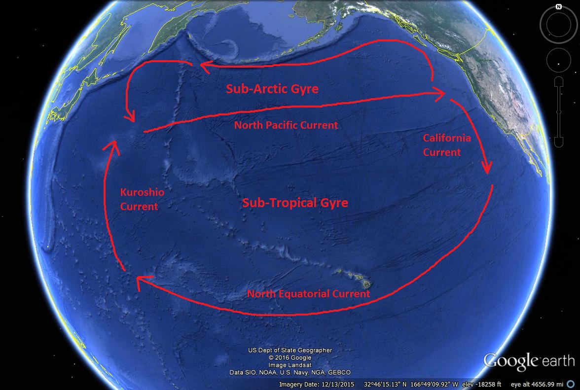
North Pacific Gyres
This was before the days of the internet, if you can remember that far back, but word went out by various archaic means, and the scramble was on. The shoes were in remarkably good shape. They float sole-up, with the uppers protected under water from sun and bird pecking, so once they were cleaned and scraped a little bit, you had a perfectly good hundred-dollar tennis shoe, but there was a problem—you only had one. Within the shoe boxes, which disintegrated quickly, the two shoes were not attached to each other, so they all hit the beaches un-mated. Swap meets sprang up all over the place, and people gleefully traded back and forth to get a right and a left of the same size. The press was having great fun with it, and articles headlined by bad puns were hitting newspapers up and down the coast (Soles Lost at Sea, etc., etc.) One of them was read by an elderly lady named Mrs. Ebbesmeyer. Her son Curtis was an oceanographer, and she was his article-clipping service, always snipping out newspaper stories she thought he’d be interested in (I had one of those mothers too). When she showed him this one, it got his attention.
Curtis Ebbesmeyer studies ocean currents, and studying ocean currents can be pricey research. They usually use “determinate drift markers,” and those are usually one of two things: Either a satellite-tagged drift buoy that broadcasts its location daily, which is really expensive, or an MIB—message in a bottle. It’s true, oceanographers really do use these. They’ll have a slip of paper in them asking for the finder to call or write with its date and location. Even these are not cheap to deploy. The bottles aren’t free, and you have to stuff the slips of paper into all of them, and then create a good, solid seal of some kind, and then you have to hire a vessel, or rent, borrow or beg space on one, to get them into the water where you want them. It’s unusual for anyone to deploy more than one or two thousand of these, and the rate of callbacks you get is only one or two percent, so even a couple thousand of them doesn’t net you that many data points. When Curtis dutifully read the article his dear old mom had clipped out for him, his eyes lit up. He realized something no one else had realized: This was scientific gold.
He started making calls, and haunting the swap meets. The case finally broke for him when he met a starving artist in Cannon Beach, Oregon, named Steve McLeod, who was an addicted beachcomber. Steve had set himself up as a mail-order matchmaker for unrequited sneakers. He was getting some pocket money by selling them for thirty bucks a pop, but the really cool thing about him is that he kept records. He had the dates and locations of over 1,600 sneaker strandings. Curtis loved this guy. Now he had some data in hand. He decided to call an old friend at the National Oceanic and Atmospheric Administration (NOAA).
* * * *
Jim Ingraham was an oceanographer like his friend Curtis, but he was also a computer guy, and years ago he’d worked up some modeling software that has come to be called the Ocean Surface Currents Simulator, or OSCURS. It was only for investigating the migration of salmon (he worked for Alaska’s Fisheries Bureau at the time), and they’d never really had a ton of data with which to perfect it or explore new uses. But it seemed to Curtis that they should be able to use this thing. He reasoned that Jim should in theory be able to subtract out the swimming speed of the salmon and have a model that would work for passive drifters, like bottles, or sneakers. He ran it by him, and suggested a blind test, giving him only the date and location of the spill, and asking him to predict first landfall. How long did Jim think it might take to make the software modification? “I’ll fax the results to you in an hour,” Jim said.
Jim did pretty well. He predicted Washington in December and January and Vancouver Island in January-February. Vancouver Island had actually been first, but hey—they seemed to have a pretty good current modeler on their hands. Previously they’d only been able to test it using a single three-month trip by a satellite drift buoy. Now they could use the data from thousands of drifters—and over multiple years! They went to work, Jim on his software, and Curtis on his networking and data collecting. He was getting the beachcombing community pretty wired, making appearances here and there, and getting his name known so people would call him with data. He called the shipping company and got stonewalled, but Nike was wonderful and greeted him with open arms, opening their records for him, which were very detailed. They had the info on every sneaker by the purchase order number that was stamped into it, right down to which container it had gone into—which is why we know that one of Nike’s five containers did not break open.
Jim and OSCURS correctly predicted Northern California for 1992, and, a year later, Hawaii. Then he predicted Japan for 1994. Curtis went on Japanese television wearing pink Nikes, but he got no calls—there would be no further landfall until the next revolution of the gyre. Then the sneakers started hitting the northwest coasts again, and Jim and Curtis now had the orbital period of the Subarctic Gyre. Turns out it averages 2.9 years, for a travel rate of 6.9 miles per day. We hadn’t known that. You can thank the sneakers.
But things were about to get even more interesting. Because on January 10, 1992, another container ship named the Ever Laurel was having a rough time of it…
* * * *
When a container ship is travelling through following or opposing seas—that is, the swells are coming either from straight in front or from straight behind—an odd thing can happen called parametric rolling, and it’s hair-raising. Most descriptions of it get mathematical, but it’s so fascinating that I decided to challenge my descriptive skills and give this a shot for you. Large ships, and especially container ships, are narrow in the bow and stern for obvious streamlining reasons, but they don’t like to part with all that deck space up above, so above the water line the hull typically flares dramatically outward again and becomes much wider at the deck level. So there are these big shoulders sticking out to the sides above the bow and stern, supporting a wide deck, and they’re normally above water line, but if they do plunge into the water they are, of course, quite buoyant. So picture a ship rolling to one side twenty-five or thirty degrees (yeah, that happens all the time). It plunges that huge shoulder into a swell, and gets shoved back upright by that extremely powerful buoyancy, which is called its “righting force,” and the ship is sent rolling with great momentum over to the other side, but when it gets there—there is only air. That’s because the swell has moved on, and is now amidships, and the shoulder is just dropping and dropping into a trough. It continues to plunge, until finally the next swell comes up under it, and shoves the ship back the other way again, this time with even more force, because this time the righting force starts lower down and has more travel—and then the process repeats itself again on the first side.
An Empty Container Ship, displaying bow and stern flare, and bridge wings By user:Nico-dk / Nils Jepsen (Own work (own photo)) CC BY-SA 2.5, via Wikimedia Commons
If the harmonics are just right, it can be a self-amplifying process leading all the way to capsize. We don’t know if this contributed to what the Ever Laurel was experiencing, but we do know that she was in forty-foot swell, rolling up to 35 degrees, and that at times the bridge wings dipped into the seas. Finally, two columns of containers nearest the pilot house gave it up and burst their lashings, and twelve containers plunged into the ocean.
And so, in the second-biggest windfall of free data in the history of oceanography, 28,800 rubber duckies hit the ocean at a known place and time. I’m not making this up.
* * * *
To be accurate, only a quarter of them were duckies. The rest were actually beavers, turtles and frogs, all bathtub toys called Friendly Floatees, made by a company called The First Years, Inc. Unlike most rubber duckies, these had no squeaker or other hole in them, so they were completely sealed. These were very seaworthy rubber duckies. They were designed to withstand 52 dishwasher cycles. But they were destined for a greatness far beyond that.
A loaded container ship, with stacks eight high abovedecks. By Huhu Uet (Own work) [GFDL or CC BY 3.0, via Wikimedia Commons
Jim and OSCURS predicted Washington state for the rubber duckies in1996, and then, correctly, that some would head back north to Alaska, west all the way to Japan, back to Alaska again, and then—here’s the good part—up through the Bering Straits and into the Arctic pack ice, where it would take them five to six years to cross the pole embedded in the ice, before they were released with the melt water into the North Atlantic. Sure enough, in July 2003, a duck was sighted in Maine, though we can’t know for sure whether it was one of these pilgrims since we don’t have the duck—the couple who found it assumed that a child playing nearby had lost it and would shortly return for it, so they left it where it was. In August of the same year, a frog was reported in Scotland, but again, it is lost to history. They have also turned up in such far-flung places as Indonesia, Australia and the west coast of South America. Their journeys have been absolutely epic. Even more so than the sneakers, they captured the world’s imagination. Children’s books have been written about these rubber duckies. But for Curtis and Jim’s part, they were learning volumes about the ocean’s currents and gyres, especially the two gyres in the north Pacific. Curtis was starting to understand and describe (and publish) how a gyre is not a single wheel, but a very complex system involving both wheels turning within wheels at slightly different speeds, and also wheels counter-rotating against wheels like a giant system of gears. He started describing how different pieces of flotsam will take very different paths through it all.
Other spills came along with other lessons. They discovered that right-handed hockey gloves take a completely different path through the gyres than left-handed ones, and Curtis started to investigate how the ocean sorts things by handedness. Scientists had had an inkling about this—it’s actually a trick used by organisms like the by-the-wind sailor (Velella velella), a little surface drifter which occurs in right-handed and left-handed versions, each with its tiny sail cocked at a different angle so that the prevailing winds take half the population one way and half another, dispersing them more widely and ensuring that the entire population never strands and dies in a single weather event. It also explained why a clam in the Gulf of Mexico called the elegant Venus clam (Pitar dione), which has a right- and left-handed version created by a row of spines, will occur at the two ends of a crescent-shaped bay with eighty-plus percent of the rights at one end and eighty-plus percent of the lefts at the other.
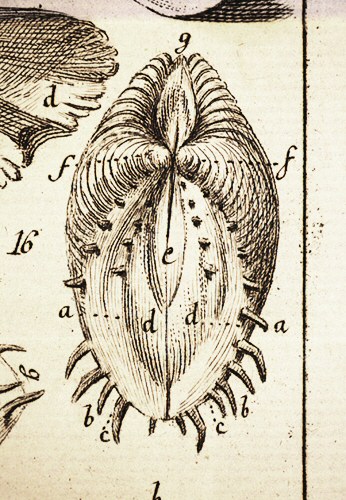
Drawing of Pitar dione by Linnaeus in his Fundamenta Testaceologiae, 1771. His scandalous descriptors: a: vulva; d: labia; e: hymen; f: nates; g: anus. Carl von Linné [Public domain], via Wikimedia Commons
* * * *
Curtis and Jim went on to track other accidental drifters, everything from derelict ships to coffins and body parts. You may not know this, but the most common body part to wash up on a beach is a foot—wearing a tennis shoe. When the rest of the body has been “disarticulated” back into the ecosystem there on the ocean floor, it is the tennis shoe that floats the foot up to the surface, where, as we’ve discussed, it drifts sole-up, protected from the ocean’s ravages. Curtis and Jim have helped forensics people investigate murders, and identify the points of origin of drowning victims and suicides.
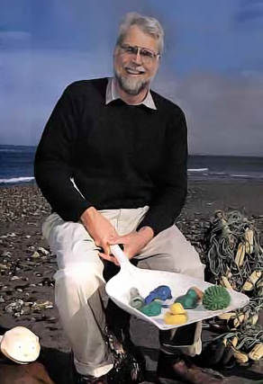
Curtis Ebbesmeyer with his scientific instruments. By Rick Rickman (http://vos.noaa.gov/MWL/dec2001.pdf) [Public domain], via Wikimedia Commons
It is mostly plastics.
That’s my next article. Now you know.
Sources:
Flotsametrics and the Floating World, by Curtis Ebbesmeyer
Moby Duck, by Donovan Hohn
http://www.csmonitor.com/2003/0731/p01s04-woeu.html
http://www.oscar.noaa.gov/
http://oceanmotion.org/html/background/wind-driven-surface.htm
http://oceanmotion.org/html/resources/oscar.htm
http://seawifs.gsfc.nasa.gov/OCEAN_PLANET/HTML/oceanography_currents_2.html
http://web.vims.edu/nmea/docs/NIKE-CURRENT_new.pdf
http://oceanmotion.org/html/gatheringdata/flotsam.htm
http://www2.gi.alaska.edu/ScienceForum/ASF10/1099.html
http://beachcombersalert.org/
https://www.washington.edu/alumni/columns/march09/alum_sneakers.html
http://www.afsc.noaa.gov/REFM/docs/oscurs/get_to_know.htm
Thanks for the article randy — very informative.
Thanks, Alex!
Fascinating article, Randy. You had me on the edge of my seat. I can’t claim to understand it all, but I’m pleased to be somewhat more enlightened about the science AND how the data collection evolved.
Thanks, Gail! Great to hear from you, and glad you enjoyed it! I’ll turn you into a science nerd yet!
Randy, Good to read your write up. Really nice. Looks like I missed many of your recent write ups. Will try to catch up on those.
Regards,
Hari
Great to hear from you, Hari!
Randy, Always a very good read. I was aware of the sneaker and duck spills but not aware of the positive affects toward science and understanding. As far as collecting the flotsam ,I predict, it will only happen when some big corporation can can get a government grant and make a fortune collecting the stuff. Thanks for you’r great efforts putting this article together. I come away from each one a bit more informed and hopefully a little smarter too. Looking forward to you’r next Thomas Morck
Thanks, Thomas! We miss you down here!
EXCELLENT and well-researched piece, Randy! While I had known about the sneakers and their furtherment of our understanding of ocean currents (thanks to Bryson, I believe), the other 80% of the article was new knowledge to me. The description of escalating parametric rolling, and its cause, is brilliant!
Regarding the Great Pacific Garbage Patch, there’s a kid who has invented a robotic skimming device (you’re probably already aware of this) which very effectively collects floating trash. I suspect we would need a few thousand of ’em, as well as a fleet of hundreds of support craft, to effectively rebuke the effects of man and his plastic down there in the patch; nonetheless I maintain that it’s doable.
All that’s needed is for us to care enough.
Thanks, By! Yeah, I’m on that kid! I’ll let you know….